Projects

The EOSC-Nordic project has ended on 30 November 2022. EOSC-Nordic aimed at facilitating the coordination of EOSC relevant initiatives within the Nordic and Baltic countries.
Read More
MAchine learning, Surface mass balance of glaciers, Snow cover, In-situ data, Volume change, Earth observation (MASSIVE).
Read More
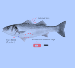
The lack of accurate modelling of fish movement, migration strategies, and site fidelity is a major challenge for policy-makers when they need to formulate effective conservation policies. By relying on the Pangeo infrastructure on the Destination Earth Service Platform (DESP), the Use Case aims to predict the sea bass behavior and develop a Decision Support Tool (DST) for “what-if” scenario planning. As a result, the Use Case will help to obtain accurate insights into fish populations by introducing the Global Fish Tracking System (GFTS) and a Decision Support Tool into the DESP.
Read More
JupyterGIS is a JupyterLab extension for collaborative GIS (Geographical Information System). It is designed to allow multiple people to work on the same geospatial project simultaneously, facilitating discussion and collaboration around map layers, spatial analyses, and other GIS data being developed. JupyterGIS provides basic support for QGIS project files, allowing users to import and export projects seamlessly between QGIS and JupyterLab. This compatibility preserves layer styles, data sources, and project settings, enabling smooth transitions between GIS work in QGIS and collaborative, cloud-based work in JupyterLab.
Read More
NICEST-2 - the second phase of the Nordic Collaboration on e-Infrastructures for Earth System Modeling focuses on strengthening the Nordic position within climate modeling by leveraging, reinforcing and complementing ongoing initiatives.
Read More
The RELIANCE project has ended on June 2023. Research Lifecycle Management technologies for Earth Science Communities and Copernicus users in EOSC.
Read More
Climate change poses risks to European communities, requiring robust adaptation strategies to protect ecosystems, economies and public health. However, fragmented data and limited interoperability across regions hinder coordinated action. Often, valuable insights remain inaccessible to policymakers and researchers seeking evidence-based solutions. Addressing this data-sharing challenge is essential for creating flexible and responsive adaptation frameworks. In this context, the EU-funded FAIR2Adapt project is advancing climate resilience by transforming data into actionable knowledge. By collaborating with the European Open Science Cloud (EOSC), FAIR2Adapt builds a user-friendly, interoperable data-sharing platform using FAIR Digital Objects and tools like the I-ADOPT framework. Through case studies and stakeholder engagement, FAIR2Adapt develops customised, scalable solutions for climate adaptation.
Read More
The TSAR project has ended on March 2023. Artificial Intelligence (AI) for the automatic detection of FDIA in transport infrastructures.
Read More